|
Chelsea: City
Of Opportunity
|
|
At the beginning
of the 1900s, Chelsea, Massachusetts, was slowly transforming from an
agricultural society to an urban and industrialized one. Industrialists needed
people to work in their factories and that meant work for new immigrants like
Samuel Gass. Rural Americans had left their farms to meet the demand but more
labor was still needed. Immigrants, first from the British Isles, and then from
southern and eastern Europe flooded Boston and other cities. Chelsea eventually
became the haven for thousands of Jewish immigrants, who, like Samuel Gass, came
to America to seek a new life.
In 1830, Chelsea was a mere 1.5
square mile peninsula housing four farms and thirty people. The tidal channels
of the harbor, Chicken Creek and Mystic River, isolated Chelsea from
Charlestown and East Boston. A creek and marshland separated it from Revere.
Only with Everett did Chelsea share a dry land border. Though it was located
only a mile across the harbor from Boston, Chelsea was hardly influenced by the
changes that affected that metropolis because at that time no bridge connected
the two locales and ferry service was nonexistent.
Then in 1831, ferry service was
instituted. Boston's burgeoning, land-hungry population spilled across the
harbor. By 1860, 12,000 people lived in Chelsea. The first new settlers were
well-off Bostonians who built sizable homes. In 1910, almost 42% of Chelsea's
residents were foreign born, however, and intense development created a
plethora of small homes on tiny lots and tenements. By 1930, once tiny, rural
Chelsea was home to 45,000 people.
It had become one of the most densely populated, industrialized cities in the
United States.
|
 |
|
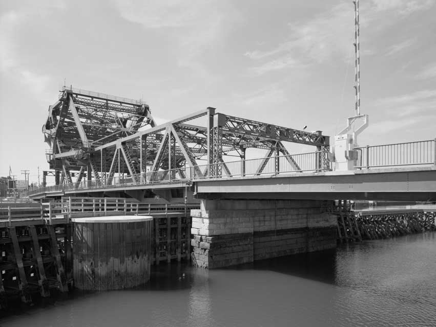
The Chelsea Street Bridge, a drawbridge constructed
between 1936 and 1937, is one of three bridges that now connect Chelsea with
Boston. Credit: Historic American
Engineering Record, Library of Congress, Prints and Photographs Division
[reproduction number LC-HAER, MASS, 13-BOST,136-28] |
More than 100 manufacturers made
Chelsea their base in 1915. Printing, leather, iron goods, food preparation,
rubber hosing and belts, and a large-scale salvage industry provided a diverse
economic base. Metals, old newspapers, corrugated cardboard, used clothing, wool
and cotton goods, all were collected and baled into hundred-pound or fifty-pound
blocks and sold to manufacturers for recycling.
The city was divided into
districts, segregated by class. Broadway ran the full length of Chelsea from the
harbor to its border with Everett, cutting the city in half. The waterfront
area housed the industrial and commercial core of Chelsea. Near the waterfront,
tenements and a mixture of industrial and institutional buildings bounded
Broadway. In the midtown area, shops prevailed. Here and northeast of the
industrialized area were the modest residences of many workers; beyond these
were the houses of the more affluent. The most prestigious homes were located in
Horn Hill, Mount Washington, and Mount Bellingham. Near Mill Creek and the
Everett boundary, stately homes lined the street.
|
|
|
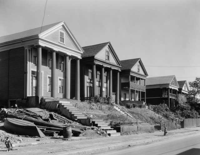
Captains’ Row on Marginal Street in Chelsea
Credit: Haskell, Arthur C., Historic American Buildings
Survey, 1934. Library of
Congress, Prints and Photographs Division [reproduction HABS, MASS,
13-CHEL,1-] |
|
 |
|
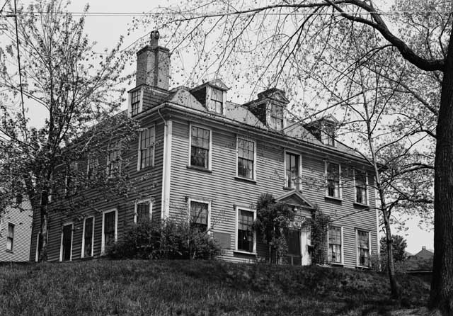
Cary-Bellingham Mansion, 34 Parker Street, Chelsea
Credit: Branzetti, Frank O., Historic American Buildings
Survey, 1941. Library of
Congress, Prints and Photographs Division [reproduction HABS, MASS,
13-CHEL,4] |